Backpacking in Hawaii

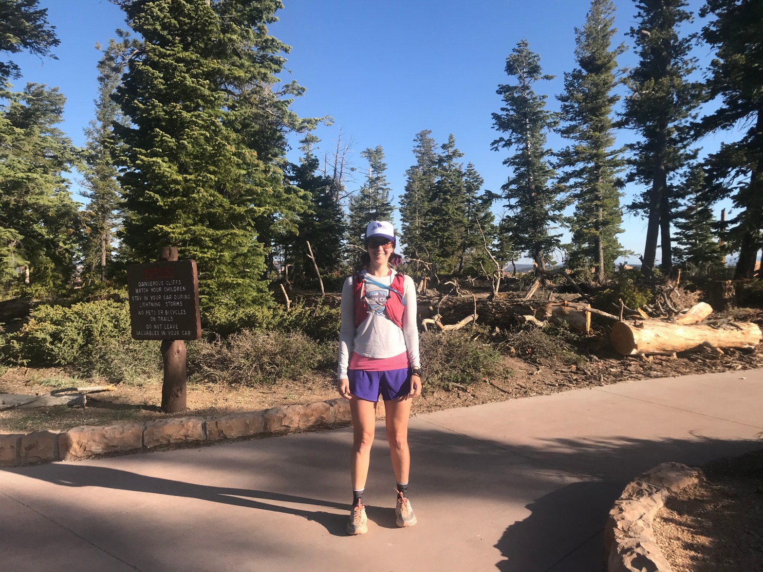
When people think of Hawaii, they typically think of black sand beaches and lava. But tucked in the Haleakala National Park on Maui are some truly amazing backpacking trails. Back in February, I had the chance to spend some time on these trails. I’ll tell you a little about the trip and some logistics on how to backpack in Haleakala on a budget. 

The Trip

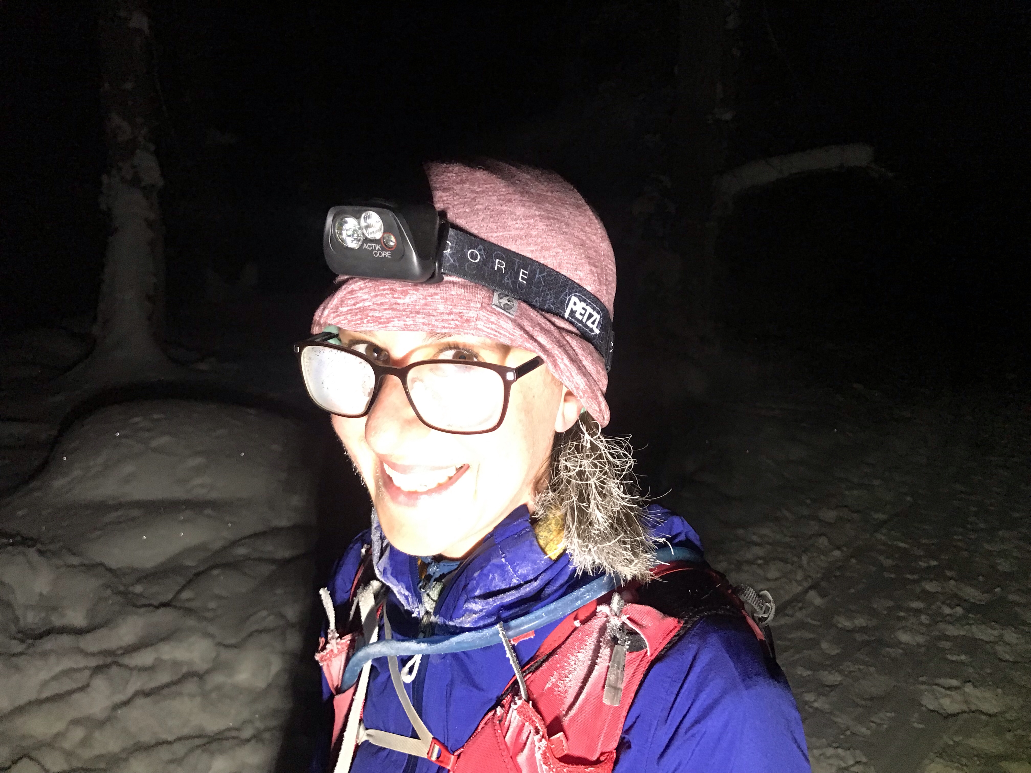
We flew to Kahului Airport and immediately made our way to the town of Kula using public transportation. For the first night of camping, we had a campsite in the front country campground, Hosmer Grove within the park boundary. In order to get there, we had to hitchhike from Kula to Haleakala National Park. Hitchhiking is generally easy and safe for backpackers heading to most National Parks and Hawaii’s were no exception. We did this to avoid a rental car which can be at least $100 per day. Since we would be backpacking for several days, we did not want to just have an expensive car sitting at the trailhead. 

Day 1 –  Hasmer Grove to Paliku – 12 miles

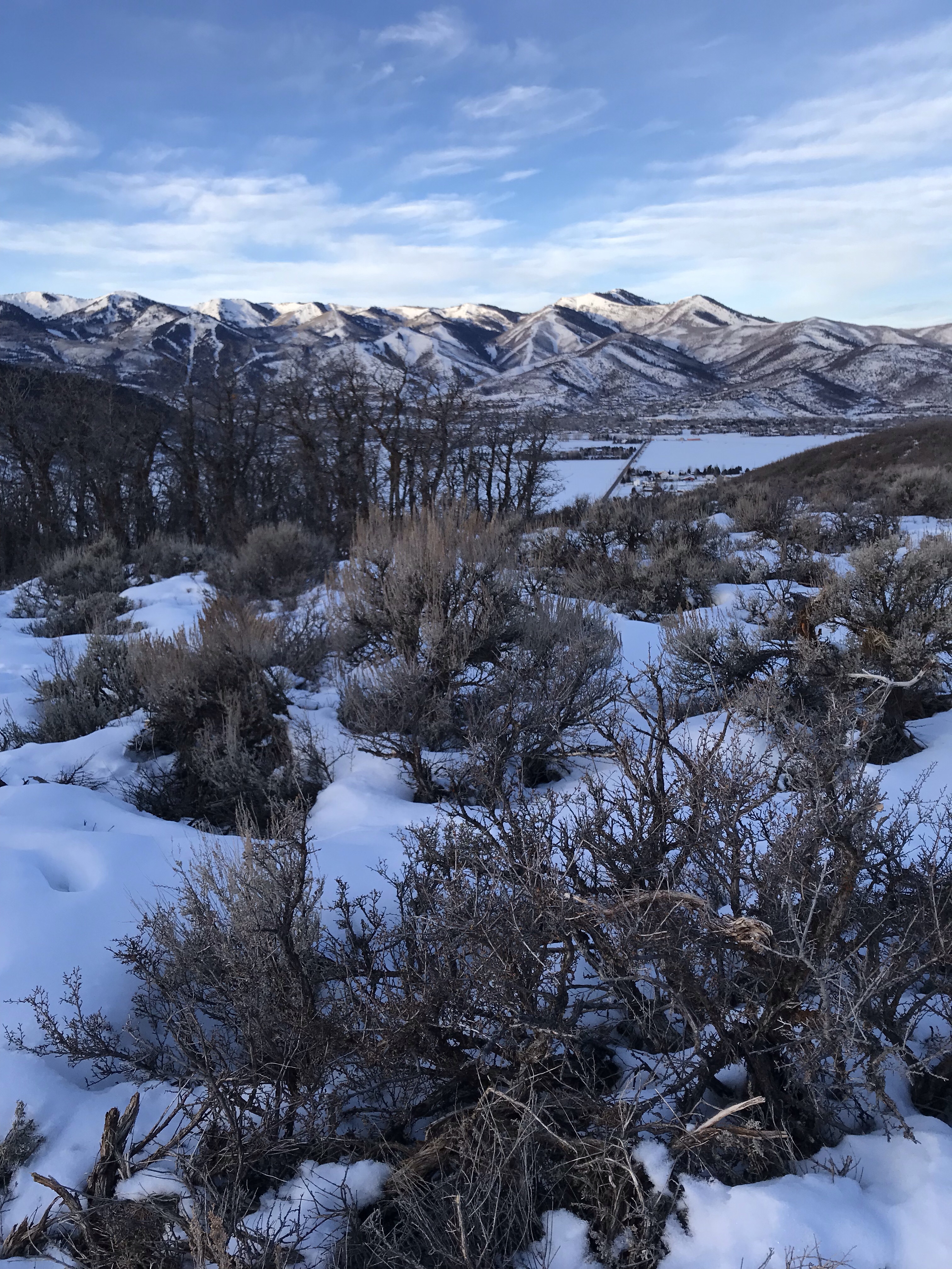
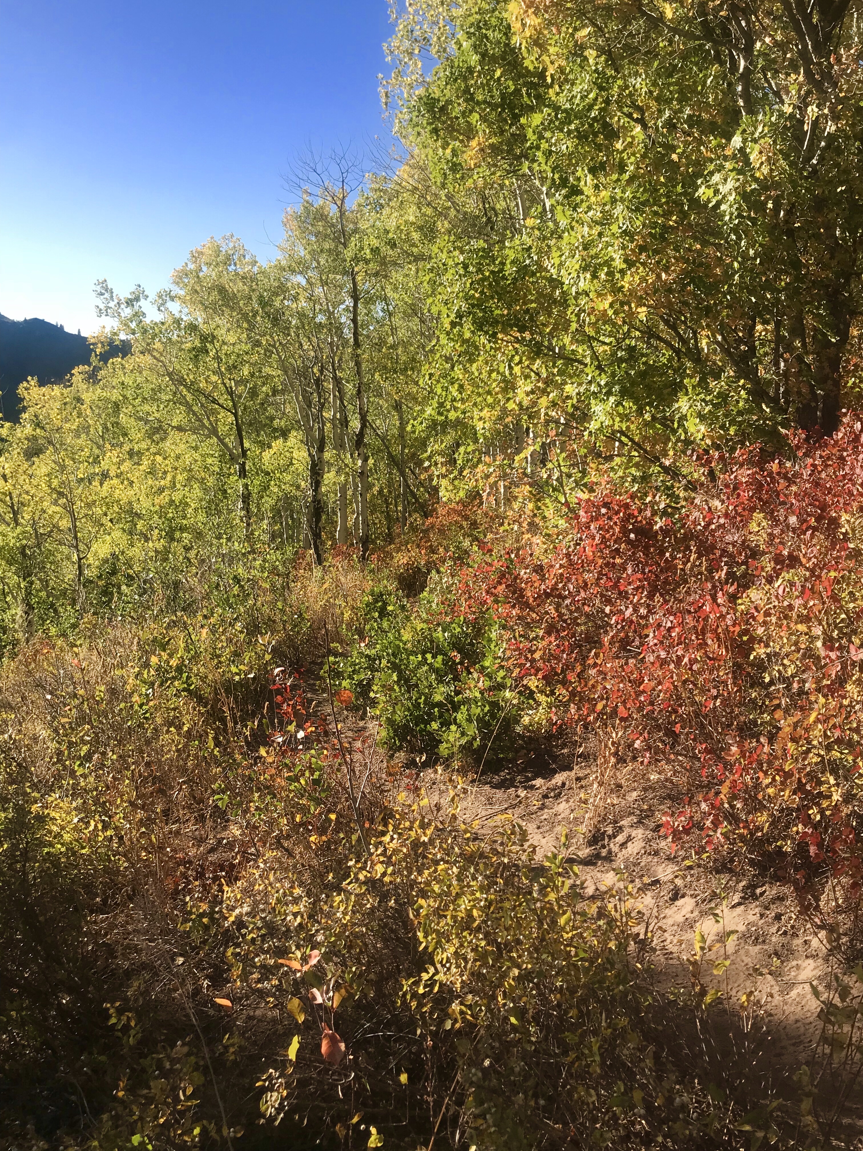
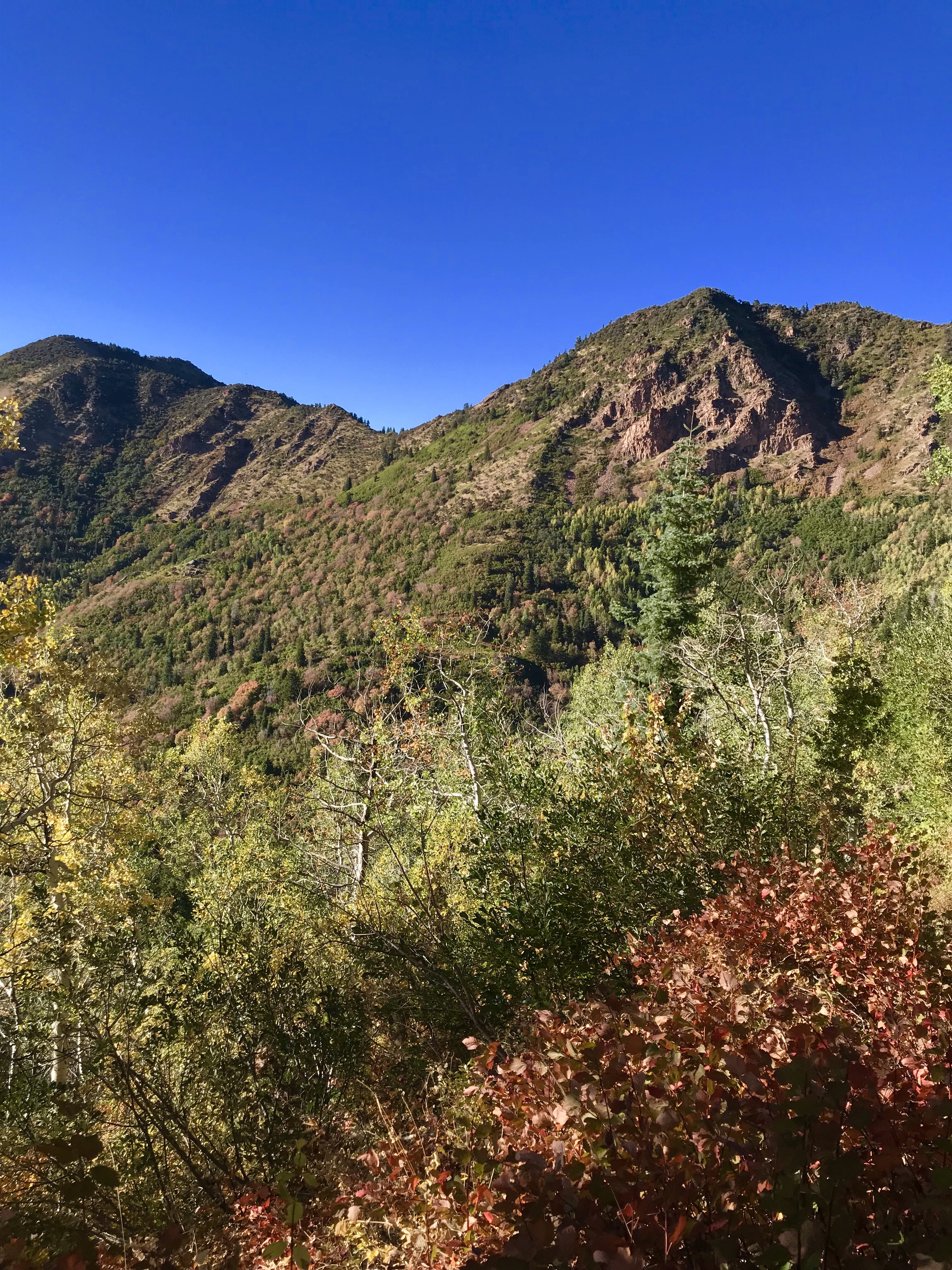
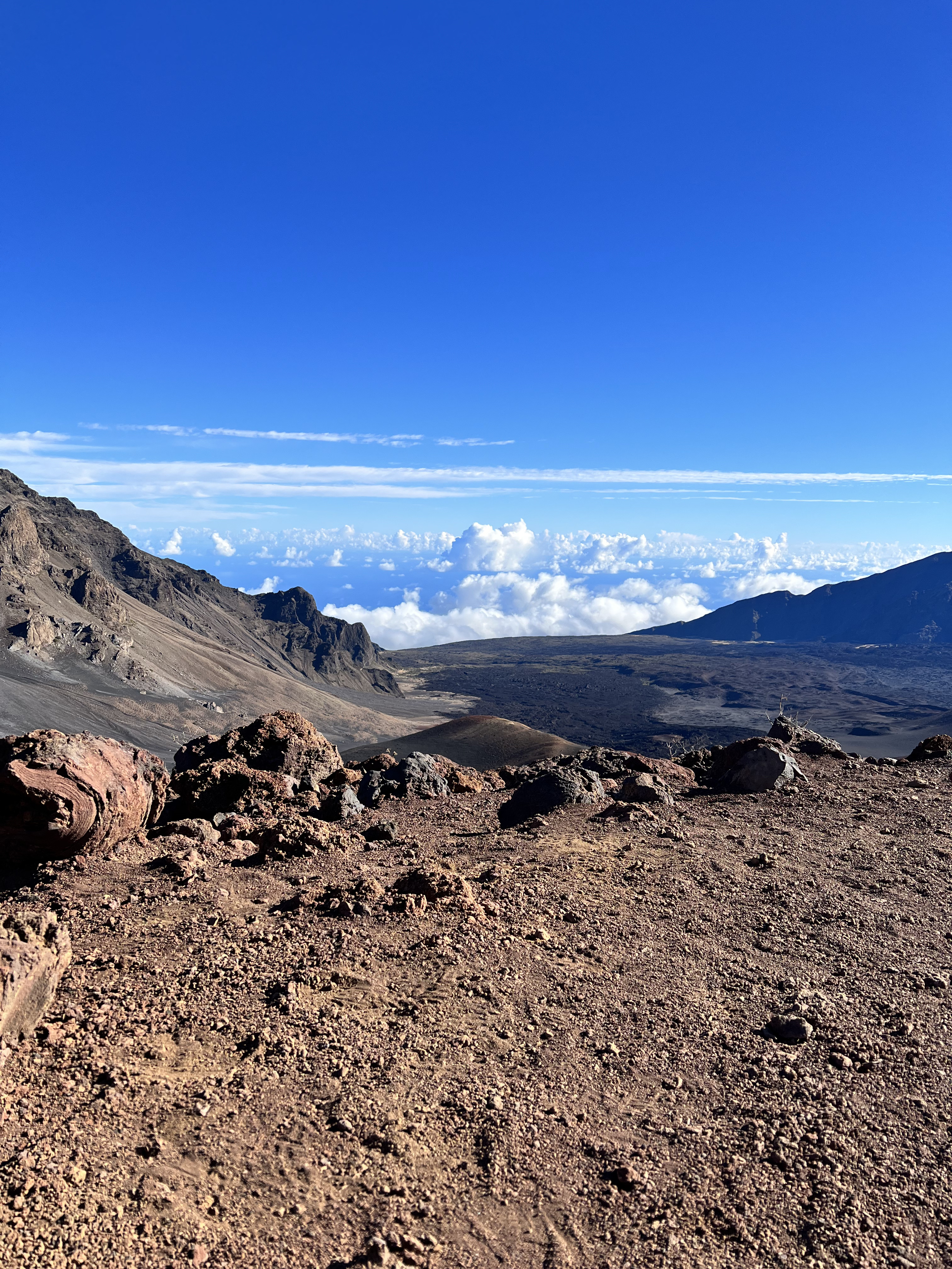
The next morning, we woke up early and made our way deeper into the park. Starting from Hosmer Grove added several miles and about 2000 feet of elevation gain from the more traditional route. However, the trail was pleasant and easy to follow and there were tons of birds and awesome views to keep us content. We continued up until the trail leveled out and gave amazing views of the clouds coming off the ocean. From here, we dropped into the crater, which was definitely a highlight of the hike.

Overlooking the ocean and cliffs.

Walking across the crater was like entering into another world. There was very little vegetation and it was clear that the volcano had been active relatively recently (the last eruption was likely about 500 years ago). Hiking across the crater, we passed one of the coveted cabins, Holua, and saw some crazy cinder cones and lava fields. 

Views across the crater
Cindercones and lava rock.

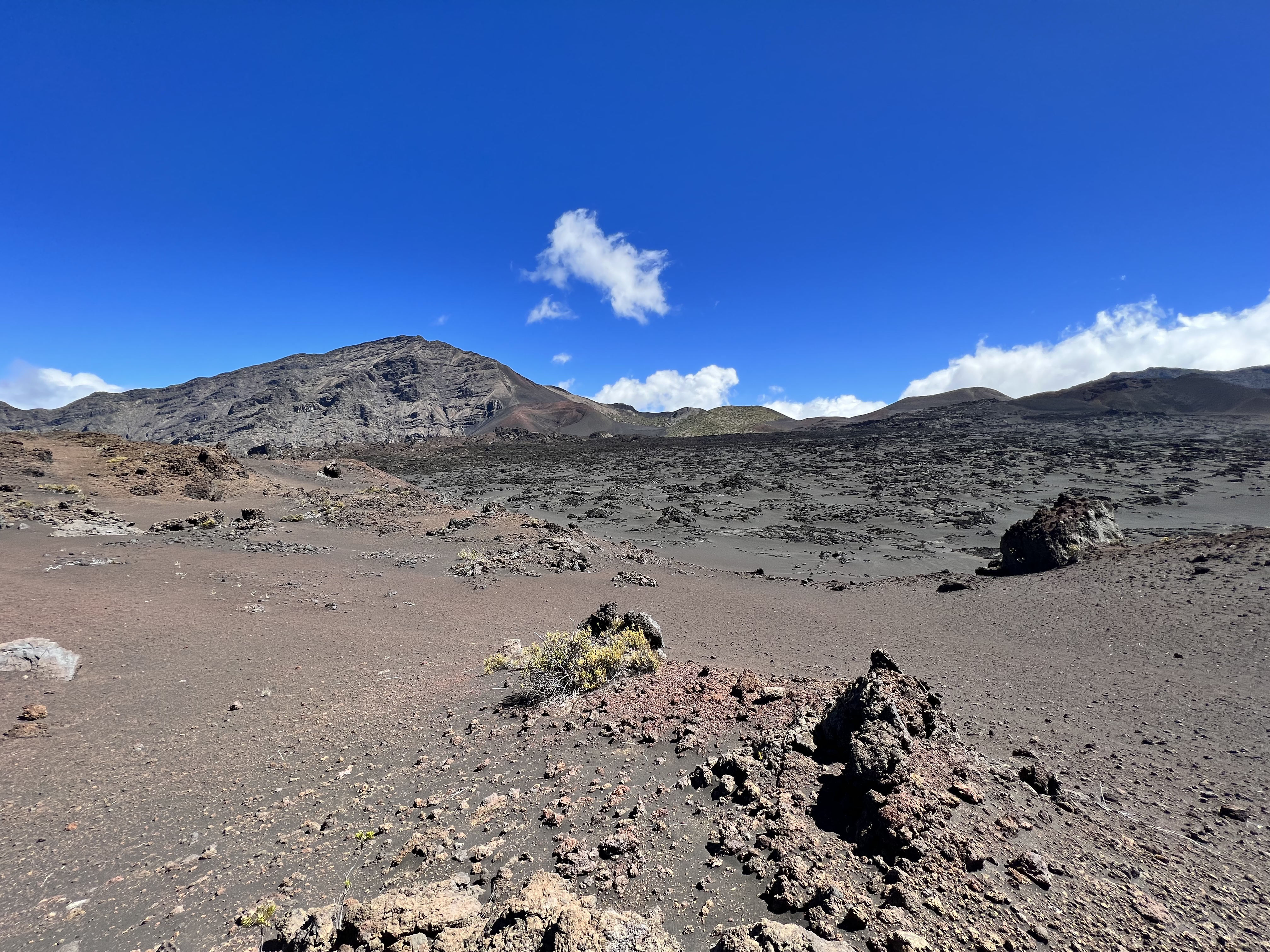
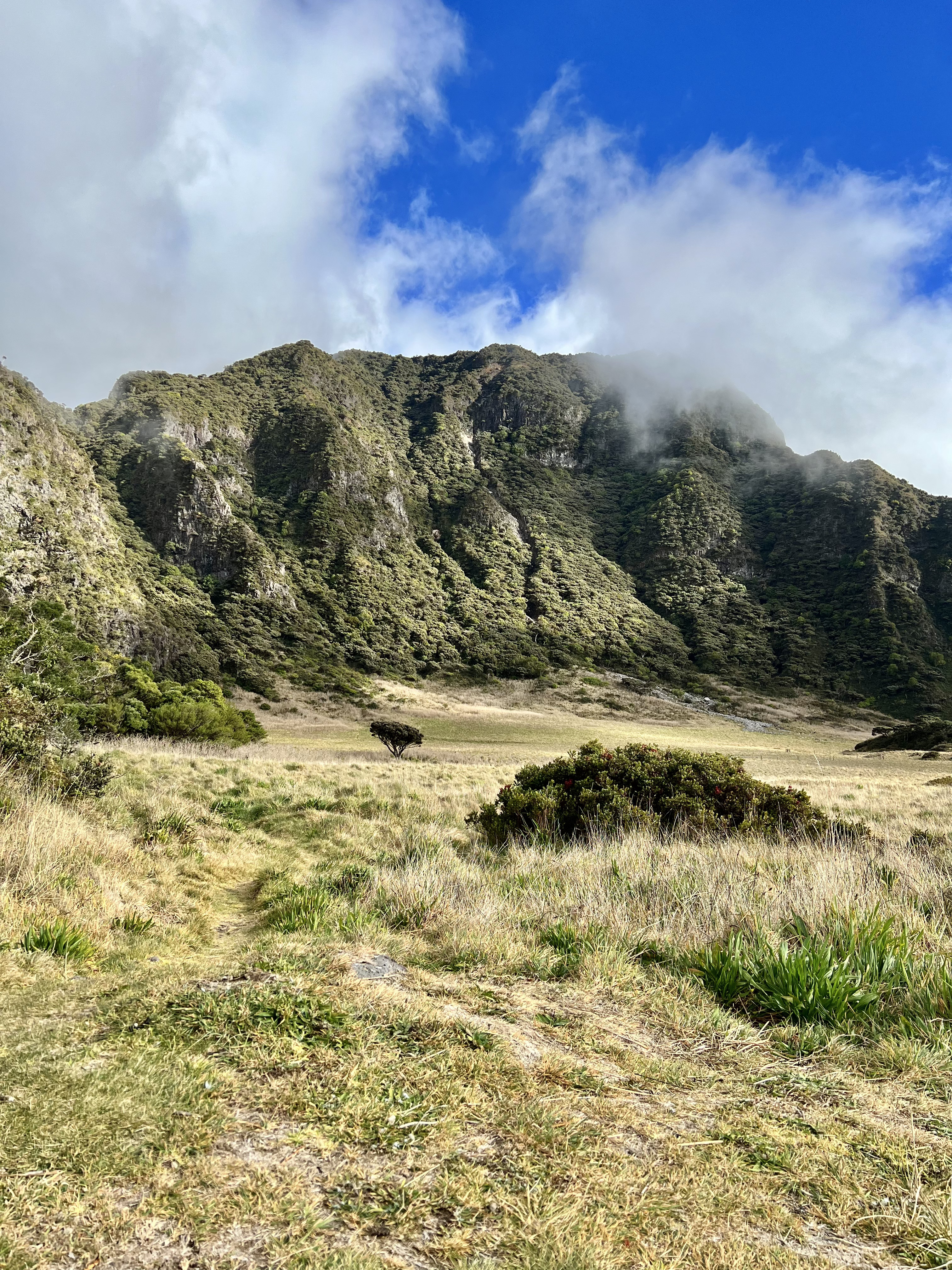
Eventually, we could see a set of very vegetated cliffs in the distance. This was the other side of the crater and where we were camping for the next two nights. The views were incredible and looked like they were straight out of Jurassic Park. This campground, paliku, has the distinction of being the site of the reintroduction of the endangered Hawaiian goose, the nene. Upon our arrival at the campsite, we did not find the birds to be very friendly and were often chased off from our water source by some rather aggressive nenes. 

The amazing cliffs at Paliku
The agressive endangered nene

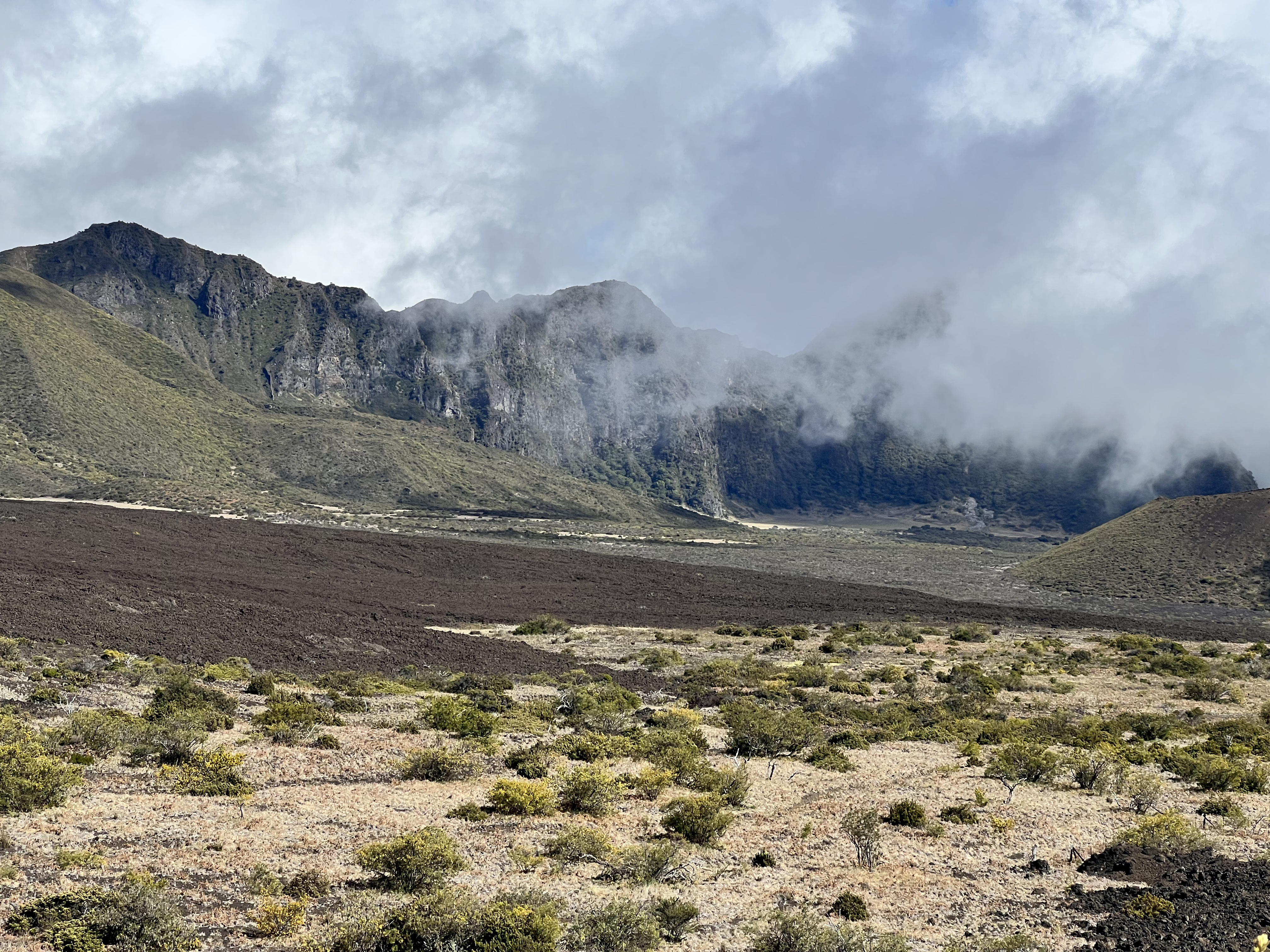
That night, we set up camp, made some friends in the Paliku cabin (we were in tent sites) and slept at one of the most beautiful campgrounds I have ever seen.

Our camp setup for the next two nights.

Day 2 – Hiking Around Paliku – 11 miles

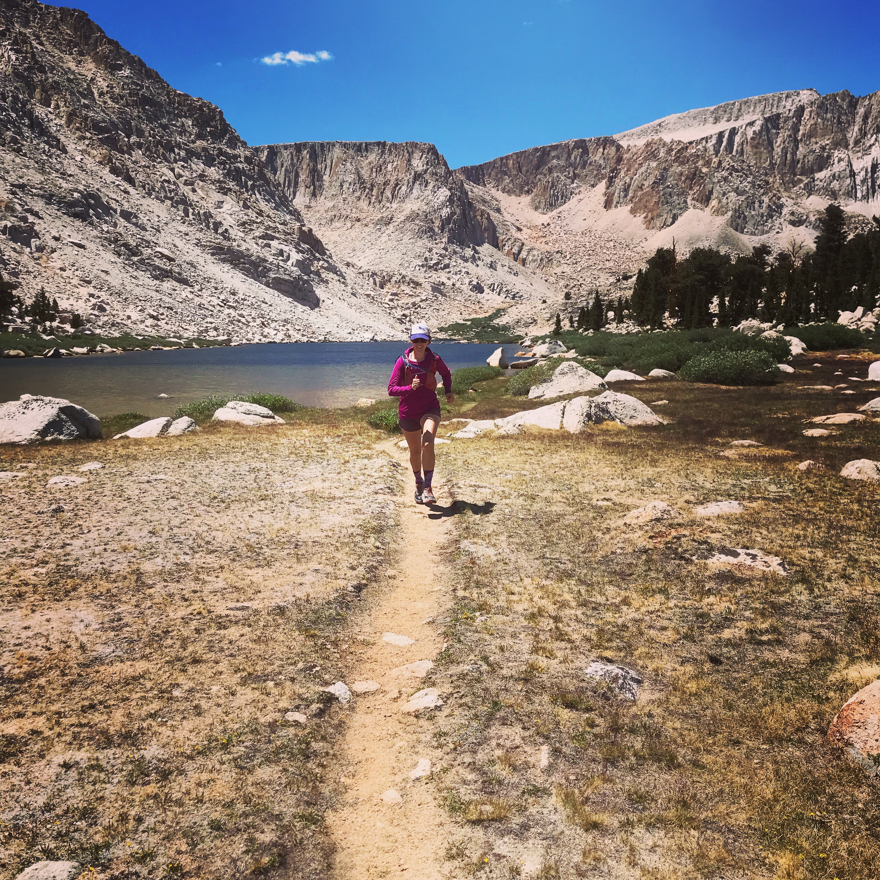
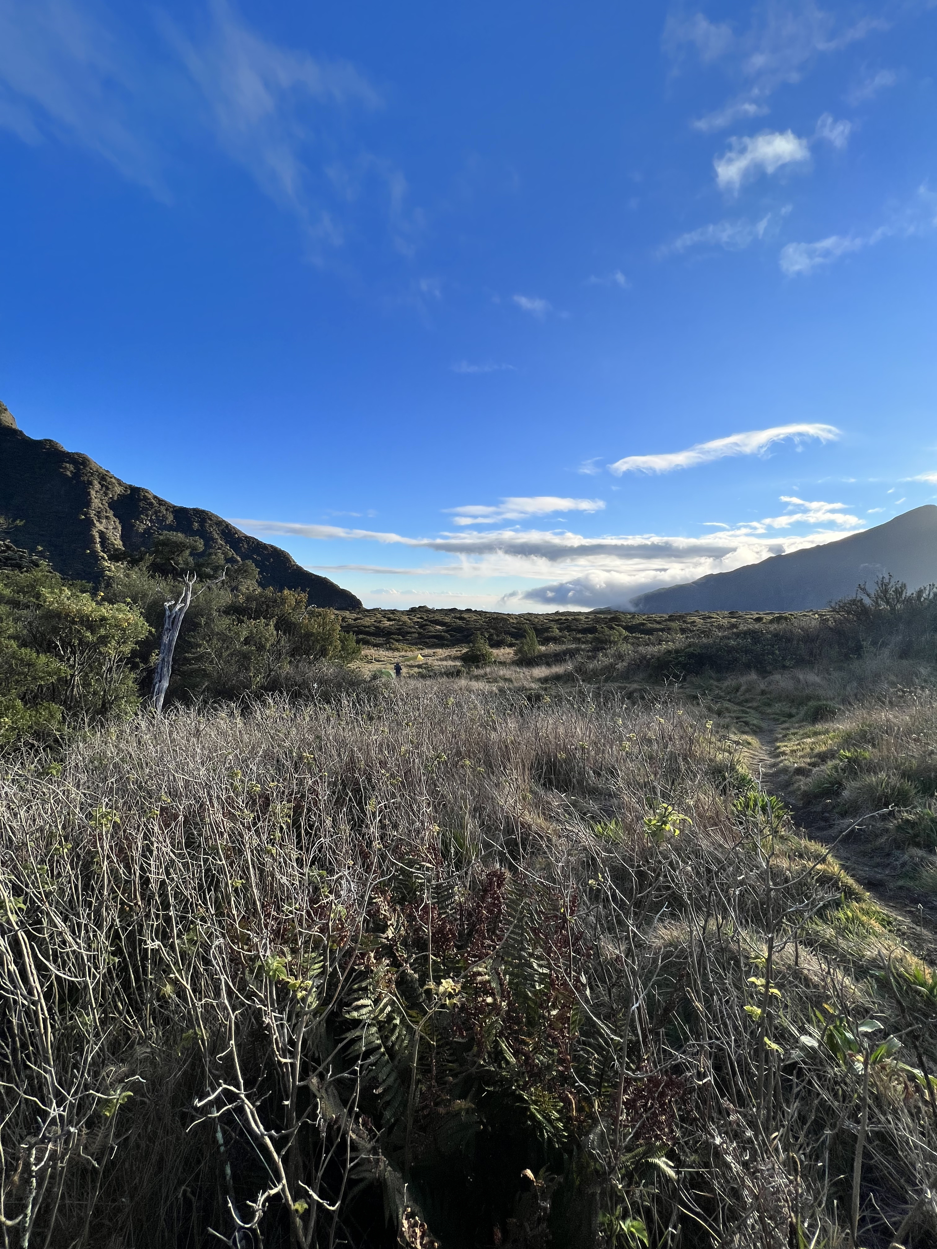
For the next day, we hiked around the paliku area and made it down towards Kaupo. The trail to Kaupo was poorly maintained and often eroded. We only hiked a few miles down and eventually decided to hike back into the crater. We did get to see a lot of really amazing views and had a rather relaxing day.

The Kaupo Gap
Clouds over Paliku.

Day 3 – Paliku to Haleakala Summit – 10 miles

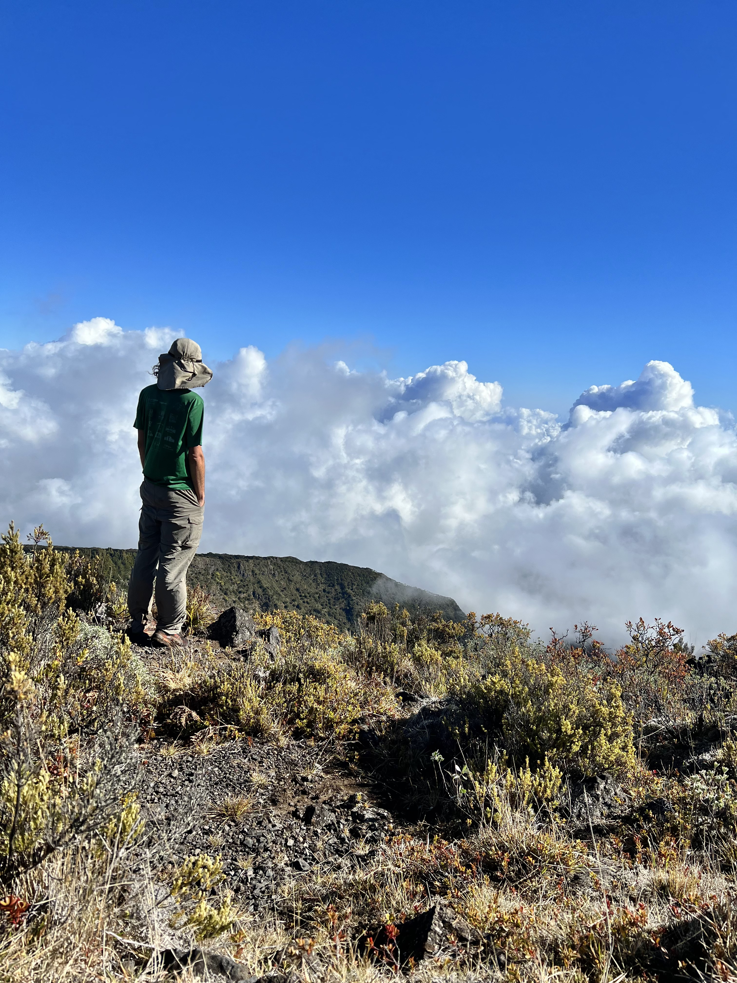
Throughout our time in Hawaii, we had some trouble adjusting to the time zone. Because of this, we were often waking up at around 4 am (Utah’s 7 am). We used that to our advantage on our day out and started our hike before sunrise. The days in Hawaii got rather hot and we knew that we had a significant climb out of the crater and to the Haleakala summit. We wanted to get an early start to beat the heat and also to insure that we were able to hitchhike back to town. 

The shifting sands
Views on the way out

The morning in Paliku was very cold and I was often questioning why I had traveled to Hawaii just to be colder than I would have been in Utah. However, once the sun was up, we were plenty warm and shedding layers. Much like the hike into the crater, the hike out was absolutely amazing. The sands were crazy shades of red and black and the views of the mountain were absolutely incredible. 

Almost to the summit!

Once we reached the summit, we got a ride all the way back to Kahului and to our hostel. Overall, it was an amazing experience and a fantastic backpacking trip. I would highly suggest taking some time in Hawaii to check out this amazing place!

If you are going to embark on this awesome backpacking trip, make sure that you obtain permits early (described below). Also, bring warm weather clothing and be prepared for cold and wet nights in the backcountry. Another logistical issue we encountered was obtaining camp fuel. There are very few places on Maui that sell fuel for backpacking stoves. I would recommend planning to eat food that does not need to be cooked. Otherwise, call ahead to make sure that the store has fuel in stock.

The Permits

We obtained our wilderness permits for backcountry camping on recreation.gov. Search for “Haleakala National Park (Wilderness Tent Permits)”. The permits are released for the 6 months following (so March 15 releases to September 15). Be sure to obtain permits early so that you can ensure that you can get the days that you need for your trip. There is also the option of getting the cabin, however, it is very competitive and limited to only one group per night (up to 12 people).

Trip Costs

We had all of our own backpacking gear and even brought some of our backpacking food from home (Frank often makes backpacking meals or we just use Mountain House meals). Here is the breakdown of our costs for our backpacking trip:

Transportation using Maui’s buses: $4 per person per day 

Campground at Hosmer Grove: $5 per night

Permits for camping at Paliku: $8 total for up to 7 nights

Backpacking meals: approximately $30 between two mountain house meals and other food

Hostel in Kahului: $119 per night

Total: $170

Trail Map

An Update…

Hey everyone!

It’s been a while since I have been on here, so I’ll give you a quick rundown on how things have been.

Getting ready to run across Bryce National Park

There was a pandemic and I started working for the Utah Department of Health.

Elly has not minded the new work from home situation.

I have done a lot of running…

Running in the Sierras last summer

And a lot of hanging out in my beautiful state of Utah.

Canyoneering through the Subway in Zion National Park

There have been a few races…

At the starting line of the Wasatch 100

I even learned to ski!

Who can complain about these views?

I am hoping to get back to a bit of consistancy on the blog. I have a few race and trip reports I am working on along with some updates about 2022 running, fastpacking and hiking goals. I hope you stick around to see what is in store! Happy Wednesday!

See you soon!

First Training Week of the New Year

The new year is an opportunity for a fresh start and often, some awesome running. This year has been different. The problems of 2018 have dragged on and are greatly affecting every aspect of my life  including my running. In the new year, I should have felt that extra push to train and make 2019 the best, but with only one week in, it’s been hard and messy.

My husband works for a nonprofit that receives funding from the National Science Foundation. With the current government shutdown, we don’t know when his paycheck is going to dry up. We are heading towards uncharted territory and I have never been one to do well with that. Since his insurance is cheaper and better, we are both on his company’s plan making our healthcare one of the many things up in the air right now. And it seems like there is no end in site.

It’s hard to run and exercise when you are exhausted from the stress of a difficult situation such as this. I find myself moving slower, wanting to stay in, and generally allowing any excuse to be the one that has me skip a run. I am no stranger to anxiety and I need running for this very reason, but it is often the first thing to go when my life gets turned upside down.

img_6600
Beautiful snow on Monday’s run

This was my training last week:

Monday: 9.1 miles along BST trail in snow (~1800 feet of gain)

Tuesday: 6.5 miles up Grandeur Peak (~2500 feet of gain)

Wednesday: 7 miles up Millcreek Road (~1200 feet of gain) + Climbing

Thursday: OFF

Friday: OFF (Should have run)

Saturday: 12.5 miles on Park City trails (~1300 feet of gain) + Climbing

Sunday: Hiking and sledding for 4-6ish miles

Total Mileage: ~38 Miles and ~7500 feet of gain

img_6625
Frosted hair on Wednesday’s run

Overall, I feel deflated this week and I’m hoping for some good news in the next few days with regards to Frank’s job. Sydney (my cat) has been having some health issues but recently seems to have made a few big steps in the right direction. I’m glad to at least have that partially resolved.

img_6628
Park City sure is beautiful

My next two races coming up are Running Up for Air (RUFA) 24 hour and Zion 100. I feel like I’m not in the best of shape at the moment, but I’ll get back there, certainly by Zion. RUFA might be a bit of a slog which I’m prepared for. Since it will be mostly walking, I imagine it will be more of a mental battle than a physical one.

My goals for next week are to drink more water (I’m terrible at that) and do some more fast running. I need to feel my legs move.

Training Next Week:

Monday: 10-12 on road + climbing

Tuesday: 10 miles on hilly trail

Wednesday: 16 miles LSD on trail

Thursday: Climbing

Friday: Run/hike up steep terrain

Saturday: 6 miles road + Hiking

Sunday: 6-8 miles + Climbing

Thanks to HoHo Runs and Taking the Long Way Home for hosting the Weekly Wrap Linkup!

weeklywrapnew

How has your new year been?


A Look Back at 2018

Happy New Year Everyone!

img_6603
We all looked so cute for New Years Eve!

It’s the first day of 2019 and I’ve been logging the miles! It was a cold day out in the mountains, but I got my first peak of the year! As I leap into 2019, I wanted to look back at what I liked most about 2018. Here’s a quick look at my year.

Best Race: Squaw Peak 50

img_5366

Squaw peak is probably my favorite race I’ve ever run. It’s beautiful, wildly challenging, and you still get a full night of sleep (unlike Javelina Jundred). I also really enjoyed the 50 mile distance. The race itself was particularly well put on and the course was perfect. Although it does give over 10,000 feet of gain, it has a very high finishing rate and I attribute that to the awesome aide stations and volunteers.  And although I did lose a few toenails in the weeks following, the race gave me the confidence needed to finish my 100-miler in October.

Best Run: Kings Peak in August

At 13,527 feet, Kings Peak sits as Utah’s crown. It’s a fantastic 28 mile trail through woods, alpine tundra, and skree fields. I met up with the Wasatch Mountain Wranglers to run it on a crisp and cool day in early August. I went alone and wasn’t entirely sure that I should go, but once I got out on the trail, I met people at my pace and stuck with them. It was a wonderful day. The route took me about 8 hours, which is a moderate pace and never felt too difficult (except at the end while I was struggling over loose rock). I did have many fantastic runs throughout the year, but this one certainly stood above the rest.

Favorite Trail: Pfeifferhorn Peak via Red Pine Lake

img_5431
Red Pine Lake Trail as the fog rolled in

I had seen Pfeifferhorn from afar many times, but this summer was the first time I climbed it. It was a foggy day, unusual for Utah, but the conditions made the trail so much better. At the top, the fog cleared and we were able to see the Wasatch and the Salt Lake Valley. It was a beautiful route and a beautiful day. This is a trail that I’ll definitely do again this summer.

Most Used Gear: Salomon Pack

img_5045
Me in my trusty Salomon pack

I went through multiple pairs of shoes, many different socks, and even switched out my spikes and trekking poles. The one piece of gear that remained constant was my Salomon Skin pack. It never chaffed, never bounced too much or hurt my shoulders. Basically it did everything it needed to do.

Most Used Running Fuel: Run Gum

As anyone who knows me will know, I am a caffeine addict. I love coffee and tea. Unfortunately on a run, it’s not always so easy to get an extra boost when you need it most. While I was training for Javelina, I was looking for ways to take caffeine during the night, but not hurt my stomach. The Wasatch Running Company suggested Run Gum and I loved it! It comes in three different flavors, all of which are great. The little bit of sugar helps too and gives me something to look forward to when the miles get long. At Javelina, I never really felt sleepy and I largely attribute that to Run Gum.

Favorite Cross Training: Climbing

img_6614

Unless you consider hiking as cross training (my physical therapist does not), I have never really been very good about doing other things besides running. I manage an okay yoga practice, but when the miles get high, my yoga practice tends to suffer. This year I really tried to remain consistent at some sort of cross training and found that climbing really works. It keeps me strong and mildly flexible and helps a lot with the mentality it takes to finish long ultras. I’m still a considerably better runner than I am a climber, but I’ve had a ton of fun going out and sending some routes.

Total Mileage: 2,040 miles

Total Vertical Gain: 285,098 feet

What are some of your favorites from 2018?

Friday Five 2.0: 5 Favorite Trails to Run in the Winter

Today is Friday and I figured I’d give the Friday Five 2.0 Linkup a try. I’ll go ahead and tell you my five favorite trails to run in the winter. Thanks to Running on Happy and Fairytales and Fitness for hosting the linkup.

Bonneville Shoreline Trail – As many miles or vert as I want

img_4628
View from the top of Wire Peak accessed by the Bonneville Shoreline Trail

This is my go-to trail that’s closest to my house and is probably where I get most of my weekly mileage. I can get in about any kind of run here. Mt Wire is along the trail if I want to cover a lot of vertical gain and plenty of miles in case I need a long run. The trail remains low enough throughout most of it to avoid snow and ice, even after the worst of storms. If it’s too snowy for the Bonneville Shoreline, it’s probably too snowy for any trail in the Wasatch.

Grandeur Peak Loop – 10 miles and 3200 feet of gain

img_6516
Beautiful views of the valley from the top of Grandeur Peak

The Grandeur loop climbs 3000 feet from a parking lot in the valley and comes back down the Church Fork trail in Mill Creek. If you run down the trail to Wasatch Blvd, you can loop the trail around back to the car. It’s only 10 miles, but it’s long and exhausting. It’s a really great loop if you need a challenging trail and a big climb. It can be done in almost any weather, although I would not want to take it on during a very bad storm.

Little Black Mountain – 8-9 miles and 2000 feet of gain

img_5080
View from the top of Little Black

Little Black rises up above the northern end of Salt Lake City. It’s not the biggest mountain, but when the temperatures drop, it’s a fun one to run. Normally in the spring and fall, I like to run it as a 14 mile loop, but in the winter, I run Little Black as an out and back to the peak. The trail can get a little icy at the top, and if it does, I’ll stop just short of the summit. It’s a great view of the Valley but is a gentle enough trail to allow for a fair amount of running both up and down the mountain.

Heughs Canyon Trail – 4.5 miles and 700 feet of gain

Heughs Canyon is great for a short easy day. The trail starts at the same trailhead as Mt. Olympus, but once Mt. Olympus really starts to climb, the trail splits off and levels a bit as it approaches the canyon and a waterfall. The trail is great in the winter except for the very end where it can get icy. Otherwise, the trail is fun, gives some pretty great views and is almost always fantastic regardless of the weather.

Pipeline Trail – Any Mileage up to 18 and little vert

img_4852
Every step leads to bigger and better views throughout the Pipeline Trail

The Pipeline is the flattest trail in the Wasatch. It starts in Millcreek Canyon and can be used to get to either Mt. Aire or to the Church Fork Trail up Grandeur Peak. The trail gives some great views of the canyon and can be used to get any mileage up to about 18 (unless you climb a mountain, where you could get much more mileage). Since the trail is so flat, there is almost no weather that will make this trail too snowy.

If you are ever in Salt Lake City or live in the area, check out some of these trails! Each offers awesome views and challenges, but are safe and fun for the crazy winter months. Thanks again to Running on Happy and Fairytales and Fitness for hosting the linkup.


Fairytales and Fitness


What are your favorite trails around you? Where do you go when the weather gets bad?

Ultra-Goals for 2019

Merry Christmas Everyone!

img_6547
I saw Darth Santa on a run in Salt Lake City.

With the end of 2018 quickly approaching, I’ve been looking back on a big year and looking forward to some more ultra-fun in 2019.

img_6238
My biggest goal of 2018!

Since Javelina, my training has been pretty chill. I run when I want, don’t when I don’t. I have not done any substantial long runs in quite some time, but everything is about to change. I have some pretty big goals for 2019 and a lot of races. In 2018, I ran my first 100-mile race and I am hoping to get a couple more under my belt in the coming year. I have most of my races planned out and I’ll go ahead and list out a few goals that I have for each of them.

Running Up for Air (February 9-10)

This is a 24 hour timed race that climbs Grandeur Peak as many times as you can. The trail is about 6 miles long but climbs about 2500 feet each lap. I am not particularly good at climbing, but I wanted to challenge myself on this one. I am just hoping to avoid the mid-night lull that I had around 2:00 am at Javelina. I would love to get through 7-8 laps, but I am more concerned with keeping my mental state good and my food intake right. I’ll mostly be walking this one, so it should not beat up my legs nearly as badly as Javelina or even Squaw 50 did. 

Zion 100 (April 21-13)

This is my main goal race for the spring. I need a qualifier for the Western States Lottery again, and although I am running another qualifier in the fall, I don’t want to rely on that one since it will be the toughest race I’ve ever run. Zion has similar elevation profile to Javelina and is not nearly as hot. My main goal is to finish, although I have another goal of PRing my 100 at it, which I think is very doable. This race goes through some of my favorite type of environment and with a bit of training, should be a pretty fun day out in the desert.

Squaw Peak 50 (June 8)

I had such a fun time at Squaw last year that I want to run it again. I’ll use it as kind of a tune up for my goal race in the fall. It has a rough elevation profile, which is something I definitely need to work on. I would love to run this race faster than I did in 2018, however, that definitely depends on how quickly I recover from Zion 100 in April. I’m hoping for a good day with little drama and just a finish with strong legs. 

Bear 100 (September 27-28)

The Bear 100 is one of the most famous and most challenging races in Utah. With about 23,000 feet of gain, this race is going to take a lot of training and a good day. I don’t have any specific goals other than to finish the race. Bear is known for it’s tough elevation profile and fickle weather. It’s a pretty local race, so I’ll have tons of support and pacers to help me out. I might run a tune up race leading to it of 50 miles-100K, but heading into the fall, my main goal will be to finish Bear.

My non-racing goal for 2019 is to blog and vlog more often. I’ll try to post on the blog 1-2 times per week and to post on the vlog once every other week. I’ll include training updates, race reports, trails that I run and just thoughts about ultra-running in general.

I hope your year was as fun and exciting as mine. What are some of your goals heading into 2019?


Running in the San Rafael Swell: The Wedge Route

The state of Utah has the highest population per capita of ultrarunners in the country. It’s no surprise why, since many of the best long routes are right in our backyard. We are within driving distance to some of the most well-known ones, including the Trans-Zion trail, Rim-to-Rim of the Grand Canyon, and of course the Wasatch and Bear 100 routes. This weekend I completed an equally awesome one, although much lesser known, The Wedge. It’s a 21-mile loop along a giant canyon called the Little Grand Canyon. But don’t let the name fool you, it’s not very little at all.

img_6502

It’s not quite the right time of year for the route, and it had about 3 inches of snow throughout making it a little more of an adventure. The Wedge is only about 2 hours and 45 minutes outside of Salt Lake City in an area of BLM (Bureau of Land Management) land called the San Rafael Swell. The Swell is more well known for climbing and canyoneering, although it does have a fair amount of awesome running routes.

Trail Stats

Total Mileage: 21 Miles

Vertical Gain: 900 Feet

Time: 3-5 Hours depending on pace and picture taking

Permits or Fees: None

I got a late start, heading out around 10:30 am. It was very cold (17 degrees) and I reluctantly got out of my car to head out on the trail. I knew with the snow the route would take a little longer than usual. I started at the Wedge Overlook (between campsites 9 and 10) and took the road about 5 miles out to the other side of the Wedge. From here, I just winded my way back to my car at the overlook.

img_6484
A fair amount of snow for the desert

Normally, the route is pretty easy with only about 1000 feet of elevation gain throughout, but with snow and icy conditions, it was a little tougher than usual. The route is on a well traveled mountain bike trail, so if you’re ever out there be sure to stay on the lookout for them. I took about 3 hours and 45 minutes to complete the entire thing, but I did stop to take a lot of pictures.

img_6491
Big jaw-dropping views at every turn

It was a pretty awesome day on a pretty awesome route. I’m hoping to get back out here when the weather is a little warmer. The best time of year for this run is in the spring or fall when the snow is gone, but the desert hasn’t gotten too hot. If you’re ever in the area, I’d highly suggest making a short trip out to this gem. There are many variations of the route to either lengthen or shorten the run.

The Javelina Jundred

img_6223
Starting line of Javelina Jundred

I love the mountains, the trails, the desert, but at mile 70 of my first 100-mile race, I loved none of that. All I loved was my bed.

I had been running for about 20 hours at this point. I had taken a conservative approach to my race and weathered the 100 degree heat of the day. At mile 60 I was sure that I was going to finish this race and by mile 70, every doubt imaginable had creeped into my mind. I wondered what business I had thinking that I could finish 100 miles. I had only ever run 50! Javelina Jundred is known for its deceptively low finisher rate and I had taken this race on without enough experience nor the mental strength to get it done.

So, there I sat, at mile 70 in the Jackass Junction aide station. A medic handed me a barf bag but offered little sympathy. I leaned over the bag as they reminded me that I’d only feel better if I ate.

Eating was very possibly the last thing I wanted to do.

img_6265
Mile 70 of my first 100-miler

People came into the aid station, laid down on the cots and told the medic they were done. Others were asleep, surely no longer able to go on to finish the race. The pull to quit was hard to resist especially when someone with a car ready to head back to the start line was asking me what I wanted to do.

I had Frank, my husband, with me by this point as my pacer. He assured me I was not going to quit. I told him that I needed to lay down for 10 minutes and then I promised that I would eat. The medic watched me as I curled up on the cot, I could tell that he was sure that my race was done. I layed there thinking of the 30 miles I still had to get done and suddenly I understood every person who has ever DNF’ed at the end of an ultra. After doing 70 miles, every mile felt like an eternity. All I wanted was to sleep.

After 5 minutes, Frank nudged me awake. “Come on, let’s go”. I shoved some watermelon down, a few pieces of banana and asked the medic “Am I going to feel this nauseous the rest of the race”?

“Probably.” He responded.

“I guess I can live with that.” I said, finally standing up from the cot.

I put the headlamp back on my head, added a few layers and after over an hour of feeling bad for myself and contemplating giving up, I left Jackass Junction to finish the race.

img_6231
My middle-of-the-night outfit

Frank and I ran through the darkness of the desert, singing Backstreet Boys songs, and looking for other headlamps in the night. Few were left. I could really tell that the race field had thinned out. Many of us hadn’t continued.

Javelina Jundred is a looped course with five 20-mile loops that bring you to the four aid stations in the desert, including one that is near the cars. Each station has a theme, and they are all pretty comfortable, which is a problem for anyone contemplating a DNF (Did Not Finish). As we neared Coyote Camp, I could hear a few howls in the distance. It was surreal to be out there so late in the night.

We breezed through the aid station and made our way back to the start/finish line where my crew captain, Lindsay, was worrying that I was about to come in to DNF. I recently had the realization that at the rate I was going, I would have to deal with the heat again on Sunday morning after a nearly 100 degree day on Saturday. I entered the aid station in tears, but I wasn’t quite ready to give up.

The problem with running 100 miles is that running 80 miles is really far, but you still have 20 left. For the first time, deep into my race, I finally understood why a person would quit a 100 mile race after having already gone over 70 miles. I realized that when running 100 miles, a finish is no more guaranteed at mile 90 as it is at mile 1. Anything can happen and the further you are along in the race, the more likely something will.

In the aid station, we took off my shoes to check on my blisters. My feet looked like I had been badly burned. I had giant, pus filled blisters between every toe, on my heels, and on the pads of my feet. With my shoes off, I could no longer fit my swollen feet back into my normal size and for the last 20 miles, I had to borrow Lindsay’s shoes which were a full size larger than mine.

After tears, and a little food, I left the aid station for my final lap with my pacer Kay Kay. I didn’t know her previously to the race, so it was nice to hear her stories about running and other ultras she had crewed.

The sun came up, and once again I was subjected to the heat of Pheonix, AZ, but unlike before, I knew I didn’t have to weather it for long. I was less hesitant than on Saturday. I realized that I had already been through the worst of it. As we came into Jackass Junction one last time, I saw the same medic that tried to convince me to eat in the night. He was surprised to see me at all. No other runners had laid down on a cot and gotten back up to finish the race.

img_6236
Leaving the final aid station before the finish line.

We took off from the aid station one last time. The miles ticked by and I started getting oddly emotional. I was crying, wanting to sleep but I was also ticking by the fastest miles I had run all race. Suddenly I was seeing sub-9:00 miles (which is not slow in a 100-miler). I passed others walking to the end with tears streaming down my face and I knew that I was going to finish. Every mile was faster than the previous and as I started to see the final aid station I broke out into an all out sprint. I crossed the finish line and was handed my belt buckle. All of the effort and exhaustion was finally done.

img_6238
The finish line

Finishing a 100-mile race and a Western States qualifier has been a goal of mine for a long time. It wasn’t until recently that I had the confidence to sign up and attempt such a huge undertaking. I’m glad that I did. I learned a lot about running, myself, and ultramarathons in general, but most importantly, I learned that anyone can run an ultra. Finishing 100 miles takes no more physical strength than a marathon does, but it does take more mental strength. I’m not sure where you find the mental strength, and I have no idea where I found mine, but even in the darkest moments in my own head, I did.

Running 100 miles was wonderful, terrible, exhausting, exhilarating, and quite possibly the greatest thing I’ve ever done.

I can’t wait to do it again.

Hiking in Mill Creek Canyon

Hey everyone!

I am still around, diligently training for the Javelina Jundred in October. It is 35 days until the race, so it’s really go time right now.

As you’ve probably noticed, I changed my blog name!  This has been a long time coming. I really wanted to refocus the blog on my mountain adventures and ultramarathons and since I do run in the Wasatch, I thought it was a fitting name. The Wasatch is my home and even when I am not actively running in them, they are there reminding me of why I love Salt Lake City so much.

Training for Javelina has been hard. Utah is still hot and I’ve lacked the mental focus it takes to get through the final stretch to the training. Luckily I’ve been healthy and without injury, but my confidence and mental strength has really taken a hit over the last few weeks. It’s hard to feel the never-ending task of training. I do find that the miles get easier, but my long runs just keep getting longer.

Earlier this week, I was feeling a little burnt out, so Frank and I went on a short hike in Mill Creek Canyon. The leaves have been changing and I needed to check out fall while it lasts.

img_5847
We are in peak color season!

We started at the Mt. Aire Trailhead at Elbowfork in Millcreek and took the Lamb’s Canyon Trail to pass (affectionately known as Bare Ass Pass).

img_5841
View from Bare Ass Pass

The trail meanders through the woods on a south facing slope. It’s pretty steep and gave us about 1,400 feet of gain.

img_5843

img_5829

Normally wildlife is pretty scarce in the Wasatch, but we did manage to see a couple of grouse running down the trail.

img_5833

Overall it was a 3.3 mile hike and only took us about 1:20 minutes to do.

What do you do when you just don’t feel like running?

Squaw 50 Vlog Recap

Better late than never, right?

Sorry about my lateness! I made a vlog talking about the Squaw 50. Check it out and hear about running a 50-miler for the first time. It was a great race and I am so glad that I did it. Honestly, I am not-so-secretly planning my return next year. 🙂

Click “like” and Subscribe for more updates as I trail for the Javelina Jundred.